From The New York Times: "BEIJING — One Friday more than two years ago, an air-quality monitoring device atop the United States Embassy in Beijing recorded data so horrifying that someone in the embassy called the level of pollution “Crazy Bad” in an infamous Twitter post. That day the Air Quality Index, which uses standards set by the United States Environmental … [Read more...]
NASA GOES captures Hurricane Sandy

Amazing images of Hurricane Sandy courtesy of NASA GOES satellites: Video from NASA GOES online here. You can also buy a print of a NASA GOES image from 20x200 with net revenue to benefit the American Red Cross - just one of many ways to help out the recovery efforts, of course. … [Read more...]
Images of September 8th NYC tornadoes
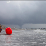
From The New York Times: Radar images / commentary from the US National Weather Service here. … [Read more...]
Hurricane Isaac
From Rebecca J. Rosen for The Atlantic: This comes from hint.fm, a collaboration of data-visualization stars Fernanda Viégas and Martin Wattenberg. Their wind map provides a nearly real-time glimpse of the wind flow around the United States, based on hourly data drawn from the National Digital Forecast Database. "So," they write, "what you're seeing is a living … [Read more...]
Hurricane Irene from space, etc.
As Hurricane Irene (the size of California) moves up the east coast, and NYC prepares with its first-ever system wide MTA shutdown at noon today, SP Weather Station is removing its instruments temporarily from the rooftop of Flux Factory. Batten down the hatches, East Coast. NYC evacuation zones: http://project-s3.wnyc.org/news-maps/hurricane-zones/hurricane-zones.html … [Read more...]